 By admin
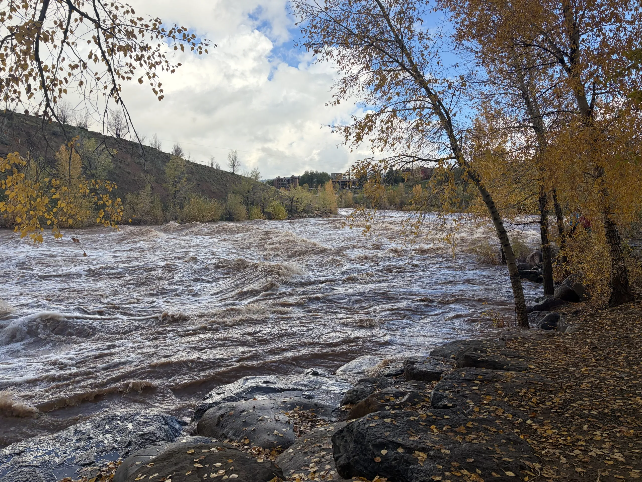
Communities in southwestern Colorado and the Four Corners region that faced devastating floods this week will get a break Monday from the storm system that forced evacuations and damaged homes.
Gov. Jared Polis declared a disaster emergency for 12 counties due to flooding in much of southern Colorado. The floods have caused helicopter rescues, destroyed bridges and closed roads while rain has continued to fall since Wednesday.
“The good news is all this precipitation we’ve been having will be out of here, will be in Kansas, by sunrise tomorrow,” Stephen Hodanish, a National Weather Service meteorologist in Pueblo, said Sunday afternoon. “Any new rain that we do get between now and tomorrow morning is not going to cause any significant flooding issues.”
Southern Colorado should expect to dry out through Friday, but another “pretty impressive” storm will be rolling over Colorado by next weekend, he said. “That system for next weekend looks colder, so we just might get quite a bit of snow versus more heavy rain.”
The governor’s declaration engages the State Emergency Operations Plan and authorizes the use of the Colorado National Guard. It applies to La Plata, Archuleta, Montezuma, Dolores, Hinsdale, San Miguel, Ouray, San Juan, Mineral, Alamosa, Rio Grande and Conejos counties.
Once the floodwaters recede, officials will be able to enter, document and assess damage. These assessments help the state determine whether it needs to request additional support from the federal government to help impacted communities.
“It was a lot of water. I don’t know if I’ve ever seen water to this extent,” Vicki Shaffer, a public information officer for the Archuleta County Sheriff’s Office, said. “Pretty much every spot on the ground that can hold water was full of water.”
She drove four hours from Montezuma County to assist the sheriff’s office — normally a 90 minute drive.
In Archuleta County, roads were closed Saturday, including Wolf Creek Pass, parts of state highways 160, 151 and 17 and county roads 500, 339 and 337. Up-to-date road conditions can be found at COTrip.
“The damage is pretty significant to several of the county roads,” Shaffer said. “It’s going to be a long-term closure.”
Along the way, she passed an RV that was knocked over during the flood and floated downstream, forcing its residents to be rescued.
“That was pretty shocking to see,” she said.
Officials pointed community members to the evacuation center at Pagosa Lakes Property Owners Association Clubhouse, and to bring small animals to the Humane Society and large animals to the county fairgrounds.
Colorado’s emergency management office did not respond to requests for comment Sunday.
Surging water down the San Juan
By Sunday afternoon, river levels were dropping. In southeast and south-central Colorado, most of the rivers and streams were below flood levels, but there is still flooding in low-lying, agricultural areas in regions like the San Luis Valley, Hodanish said.
Southwestern Colorado had received about 3 to 7 inches of rain, according to the NWS office in Grand Junction, which monitors conditions across the Western Slope.
All of that rain flows downhill into the San Juan River, which drains rivers and streams in southwestern Colorado into the Colorado River.
Read more New Castle man, two sons killed in crash of small plane
The San Juan River reached its historical peak in 1927 at about 32 feet. Meteorologists expect to see the river to peak at about 29.5 feet early Monday morning, Lucas Boyer, a NWS meteorologist in Grand Junction, said.
The San Juan River also flows through Navajo Reservoir on the Colorado-New Mexico border on its way to the Colorado River.
The reservoir stored about 883,800 acre-feet of water Wednesday, when the storm kicked into gear. By Saturday, it held over a million acre-feet, a 19.5% increase, even as dam managers cranked open the reservoir’s release valves to send more water downstream in the San Juan River.
The San Juan and its tributaries, like the Animas River, flow through northern New Mexico, where officials were assessing whether bridges were safe to cross and pilots were flying over the area to do aerial assessments, according to officials from San Juan County, New Mexico.
“When life gets tough, we are good at helping each other,” San Juan County Commissioner Silvia Stubbs said. “This is a tragedy that can be a blessing too. It can show us how we can work in unity and help each other.”
In southeastern Utah, members of the Navajo Nation’s Aneth Chapter met to discuss their emergency response efforts Sunday.
Some community members received an alert to evacuate at 5 a.m. On Sunday, emergency managers were monitoring another swell on Montezuma Creek, bridge safety, and areas where water was flowing over roads. The chapter leaders were coordinating donation sites for the area, like the Aneth Chapter House, resources for pets and pet owners and communication with the public.
No injuries were reported as of Sunday afternoon.
“Some of these families have been at home for several days and they haven’t been able to get out,” Carma Claw with the Aneth Chapter said. “Heavy equipment to do some road grading to these private homes is going to be one of our first initiatives to get people help.”
Impacts of El Niño
October storms caused flooding in the same region last year causing hundreds of people to evacuate. Some communities, like Vallecito in La Plata County, were still recovering from those floods this summer.
Last year’s flooding also locked moisture into the ground as soils froze, a boon for forests and farmers alike during this year’s hot and dry spring and summer.
For months, climate and weather experts have been monitoring warm conditions in the Pacific Ocean as they developed into a strong El Niño.
El Niño and La Niña are opposing climate patterns that can affect weather worldwide. A “super” El Niño happens when water temperatures in parts of the ocean are much warmer than normal.
This storm is a classic symptom of El Niño conditions in the Pacific Ocean, the meteorologists said.
The warmer ocean temperatures increase moisture in the atmosphere. The jet stream, narrow bands of strong wind, picks it up and carries it over southwestern Colorado.
“We’ve been talking about the El Niño, how it’s going to impact the weather. Well, you’re seeing the impacts of what an intense El Niño can do,” Hodanish said. “We are not done, I can tell you that.”
Read more Colorado thriller author Carter Wilson saves one creepy creation for his annual Halloween display